Stair
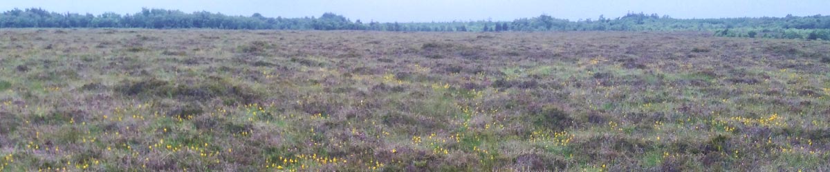
Our LIFE Project site in County Longford is just a fraction of a once huge bog that formed in this area over 10,000 years ago.
Raised bogs are found almost exclusively in central Ireland, chiefly in the Shannon basin, and in Longford they were plentiful. Raised bogs, like Ardagullion, began to form only at the end of the Ice Age, over 10,000 years ago. When the land surface was new after the glaciers retreated, what was left behind was a poorly drained plain, pockmarked with hollows and depressions. These depressions filled with water, creating thousands of tiny lakes.
Ardagullion formed in one such area.
Around 7000BC, not long after the Ice Age ended, the small lakes were surrounded by a woodland. Stone-age (Mesolithic) hunters would have fished around the shores of the lake.
At the edges of the lake, communities of reeds were developing. These reed communities extended into the lake, depositing peat (poorly decomposed vegetable matter) on the lake bed. Over many years, this peat built up and up, choking the lake, until it began to emerge above the surface of the lake. Only small areas of open water remained by 1500BC, and these would have had a special, probably religious, significance to the Bronze Age farmers nearby.
The water table rose until no water was running into the lake from surrounding land, and it stagnated. The peat and water thus became acidic, further preventing decomposition. The oak, ash and elm which now grew were partly cleared by farmers.
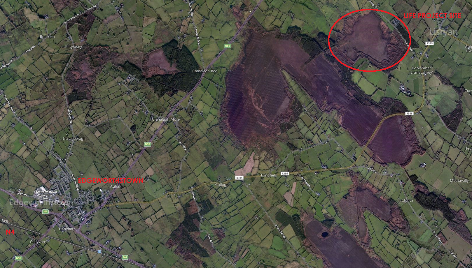
Area map (from Bing Maps) showing Ardagullion as the northern edge of a large bog system which formed from a lake.
By 500BC, the lake had been completely filled in, becoming a raised bog. The dome extended higher than the edges of the bog, carrying the water table upwards with it. Thick cushions of sphagnum moss would have covered the mass of peat. For a period around this time, the climate was drier and large trees were able to grow on the bog itself. These have been found buried in bogs today, along with grasses that could not survive there now.
By 500AD, in the Celtic period, the climate had turned wetter and the bogs became more marshy again. Their vegetation cover reverted to thick mats of sphagnum mosses. At the edges of the bog, the wetter conditions allowed areas of stagnant water to develop, which allowed the bog to encroach upon, and bury, surrounding areas of woodland. With no decomposition of waste, the bog’s dome continued to rise, becoming much higher than the surrounding landscape. This is where raised bogs get their name.
For humans, the water at the edges of bogs provided places to find iron-rich ochre (which seeped out of the bog), which helped usher in the Iron Age in Ireland. As the bogs were now too wet to walk upon or graze animals on, some Iron Age farmers built wooden walkways over them. Originally they were used for people and animals on foot, but once wheeled carts were invented and introduced into the north of Europe they became a necessity and more complex, ingeniously connected to each other in some cases.
Eventually, the trackways deteriorated and fell into the bogs, where the unique chemical structure of the bog soil and the lack of oxygen preserved these ancient structures to this date. Many of these walkways have been unearthed in recent years, including the Corlea Trackway in Longford, which has a visitor centre open to the public all year round. A recently found track at Mayne Bog in Westmeath was not as fortune (click here and here and here and here).
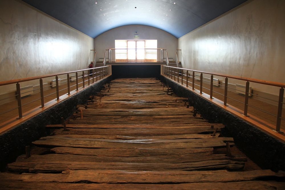
The Corlea Trackway preserved in its visitor centre near Keenagh, Co Longford.
It is uncertain how raised bogs would have evolved after this stage in their development, because significant human activity started to influence them to a great degree around 300 years ago. Most intact raised bogs vary between 3 to 12 metres in thickness, with initial LIFE investigations showing Ardagullion to be over 10.5m deep in places.
From the 1700s on, the raised bogs of Ireland were exploited as a source of cheap, readily available fuel. Most of this was cut by hand, and laid in the sun to dry before being brought home for seasoning, then burning. At the time of the famine, turf was the primary and often only source of fuel available.
In 1934, the Irish Free State set up the Turf Development Board, which bought land under compulsory-purchase orders and cut turf. Half of Ireland’s raised bogs were destroyed (at a rate of 800,000 tons per year) between 1814 and 1946. After World War 2, the government set up Bord na Móna to cut peat by mechanical means and this simply accelerated the process. In 1969, there were just 100,000 hectares of raised-bog left in Ireland, of which Bord na Móna owned 45,000 hectares. Most of this has since been exhausted.
SURROUNDING LANDSCAPE
MONUMENTS
To the west of the LIFE project site, in the townland of Asnagh in low-lying pasture, lies an interesting ringfort – rath (circled in image below). It features a raised circular area (diam. 25.9m) enclosed by a low bank of earth and stone (H 0.5m max.) with a shallow intervening fosse (Wth 4m; D 0.5m) and an outer bank (H 0.4m). The latter has been levelled from NNW–N–ESE but its outline (Wth 5.3m) is still identifiable in places. A wide break (Wth 5.4m) in the bank at E-SE with an accompanying causeway marks the original entrance.
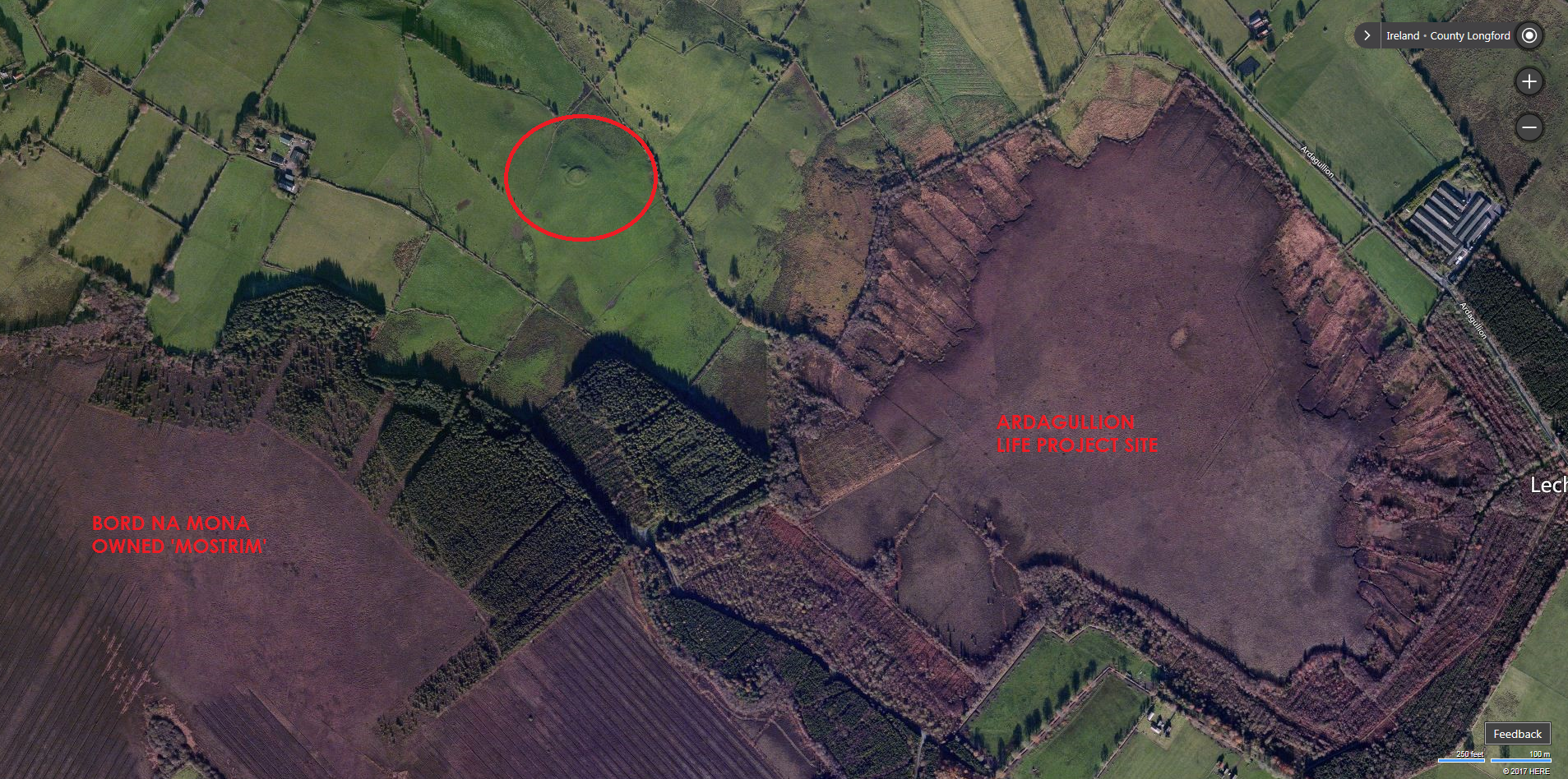
Ardagullion Bog, as seen from Bing Maps 2017
To the north west of Ardagullion Bog (just before the bog on the local road) lies a ringfort, or rath. It appears now as a raised circular area (diam. c. 50m) defined by a scarp (H 0.8-1.6m). There is no trace of a fosse. A modern NE-SW field boundary divides it into two unequal portions. The smaller portion, to the SE, has been levelled and only its outline is identifiable. Most of the rest of the rath is occupied by a modern dwelling-house with outbuildings and a laneway. The original entrance is not recognisable.