About Garriskil Bog

Garriskil Bog Co Westmeath. Pic: Skyfab/Declan Murray for NPWS
Most of Ireland’s raised bogs are in the Irish midlands, but when it comes to actual centrality, Garriskil Bog SAC is perhaps the nearest to the exact centre of the island. And not only that, it has a unique history that takes in Bruce Springsteen’s ancestors, Ireland’s most unique bog train station, St Patrick, space exploration and discovery, Michael Collins and more besides… Truly one of Ireland’s best raised bogs, Garriskil’s intriguing social history and connections make it one of the most interesting.
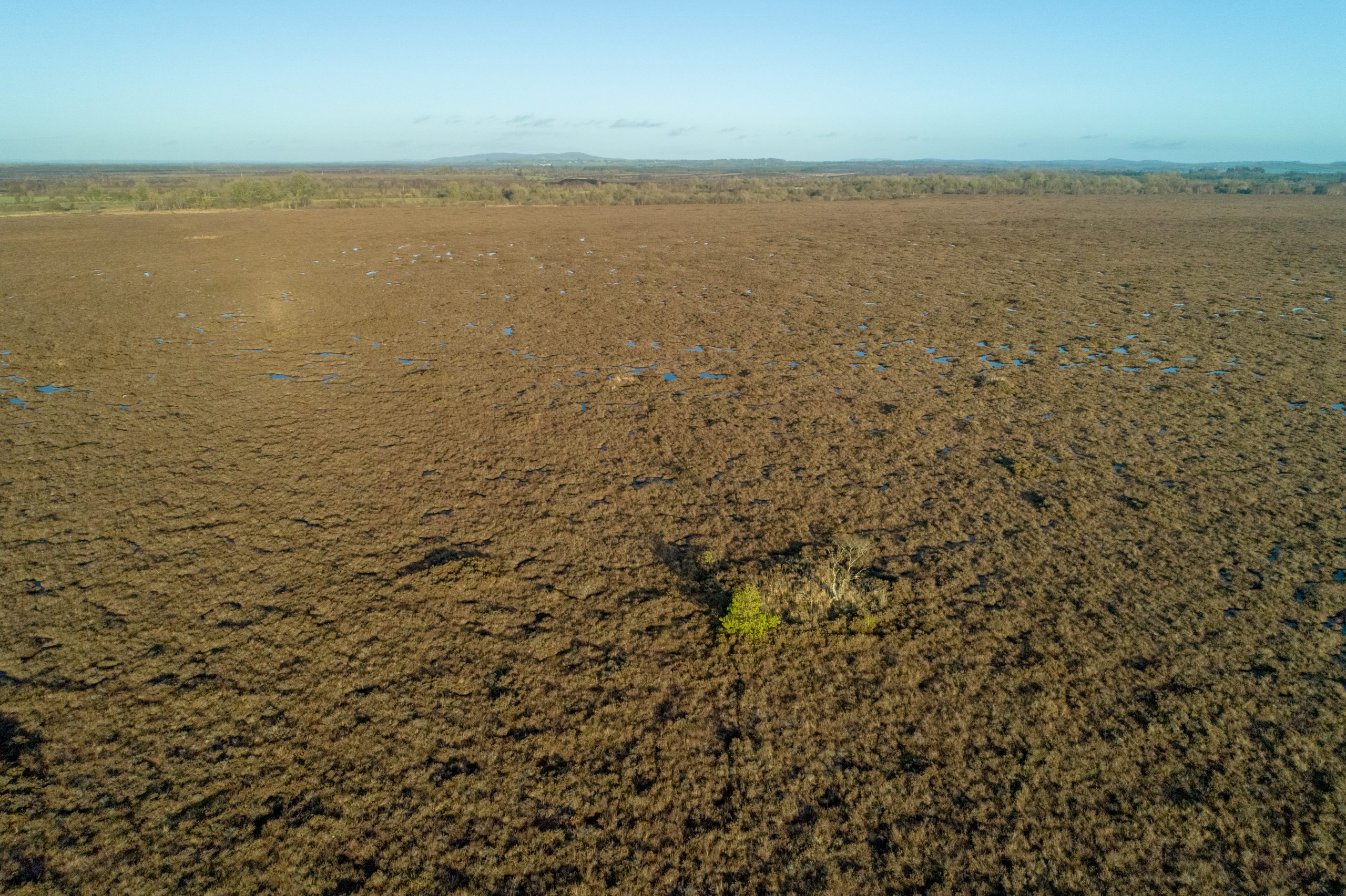
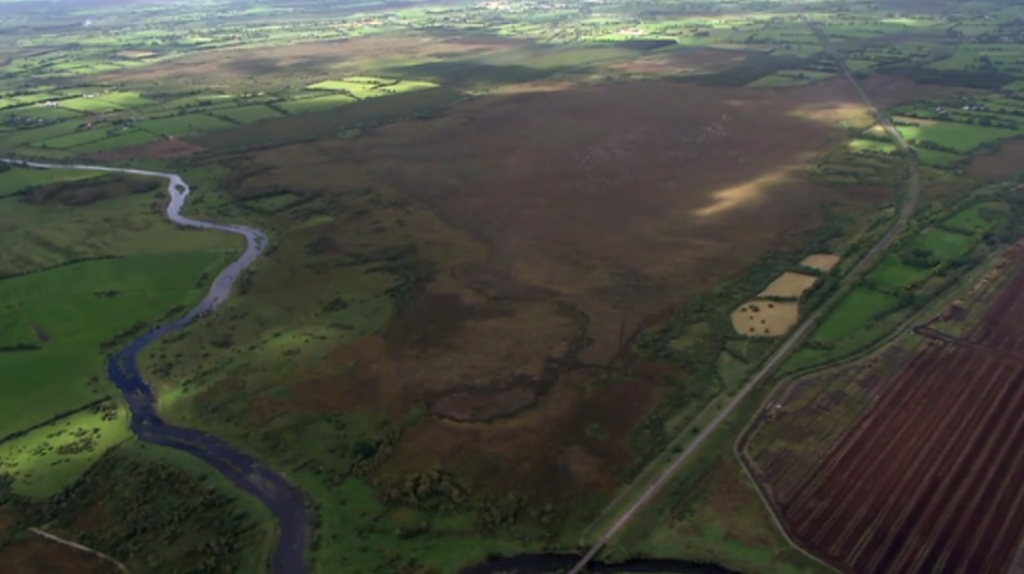
The raised bog is located in the heart of the Irish midlands in County Westmeath, just 1km from the village of Streete, 3km from the village of Rathowen, 15km from the county town of Mullingar and 2km from the historic home of the fabled ‘Children of Lir’, Lough Derravaragh. Garriskill is also visible from the exact centre of Ireland: The Hill of Uisneach.
Garriskill Bog (which takes its name from the Gaelic ‘Garascal’, meaning rough nook) is a significant site in more ways than one. It is a remnant of a network of large river floodplain bogs which developed where the River Inny enters and leaves Lough Derravarragh (the Inny winds around the southern end of the bog below). Most of these bogs are now affected by human interference, some seriously wounded, strip-mined for horticultural peat, but Garriskill is an exceptional reminder of a once common landscape of this part of the country.
We will publish our survey results here on this site in late 2021, but our project chose this site with its 2011 survey in mind. Then, the large raised bog had 51.7% of the original bog still present and contained a large, wet high quality central core of Active Raised Bog (ARB) which comprises approximately 51 ha (30%) of the uncut high bog area. This living bog is actively peat forming with a high percentage of bog mosses, hummocks, pools, wet flats, Sphagnum lawns, flushes and soaks.
At 324.81 hectares it is one of the largest LIFE project sites is considered an exceptional example of a midland raised bog. It includes 170 ha of uncut raised bog and 154 ha of mostly cut-over bog (resulting from previous turf-cutting). The LIFE project aims to add over 30 ha of ARB to the bog – an increase of well over 20%.
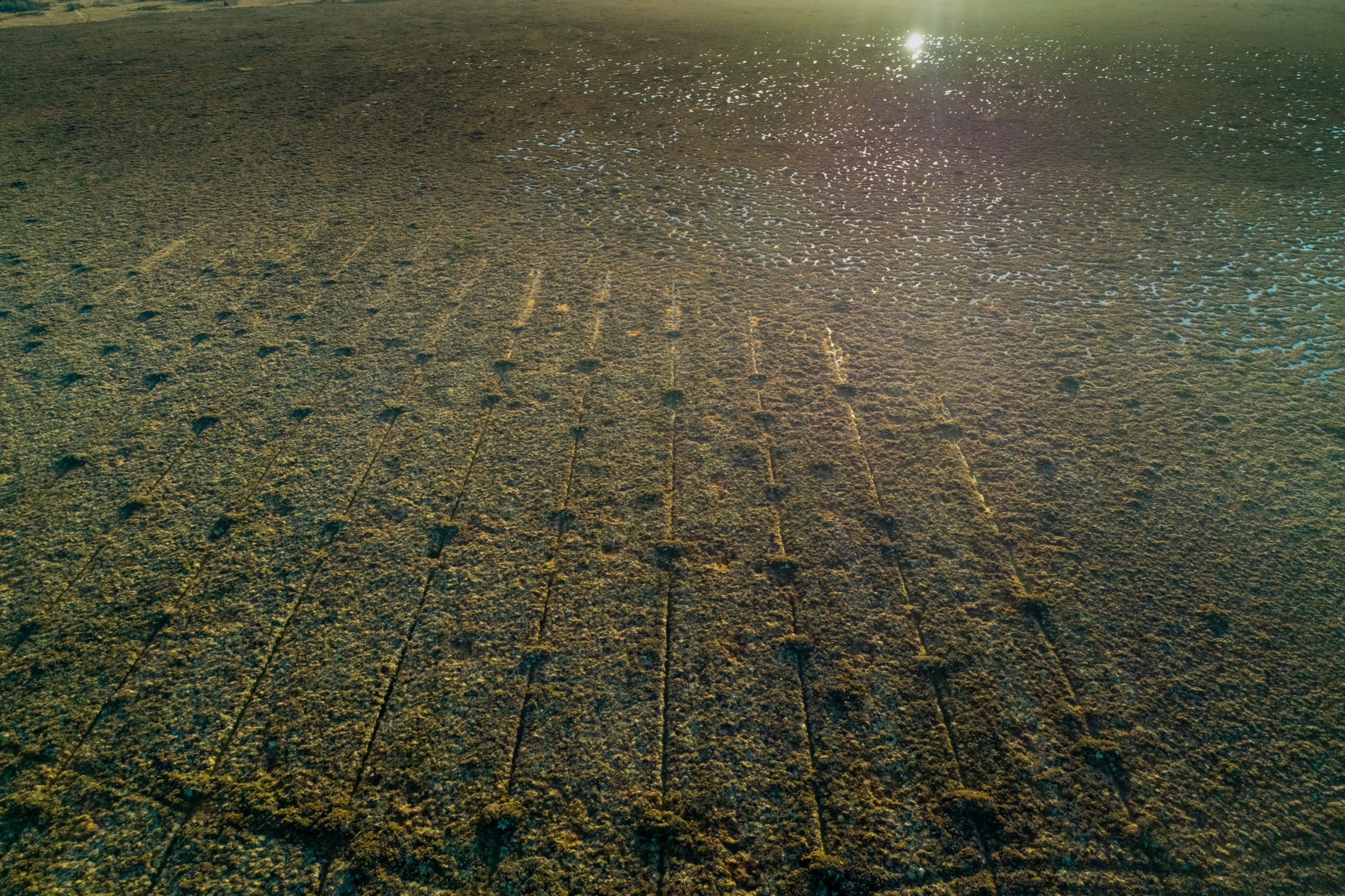
So, how did we do? Well, it was one of the first sites we restored. In February 2018 and again between September 2018 – December 2018 we carried out extensive works on both the cutover and high bog installing almost 1,100 peat dams. The work was massive, but early indications are that the bog has made a remarkable recovery with previously bone dry areas of cutover now brimming with rare flora and fauna.
-

-
-
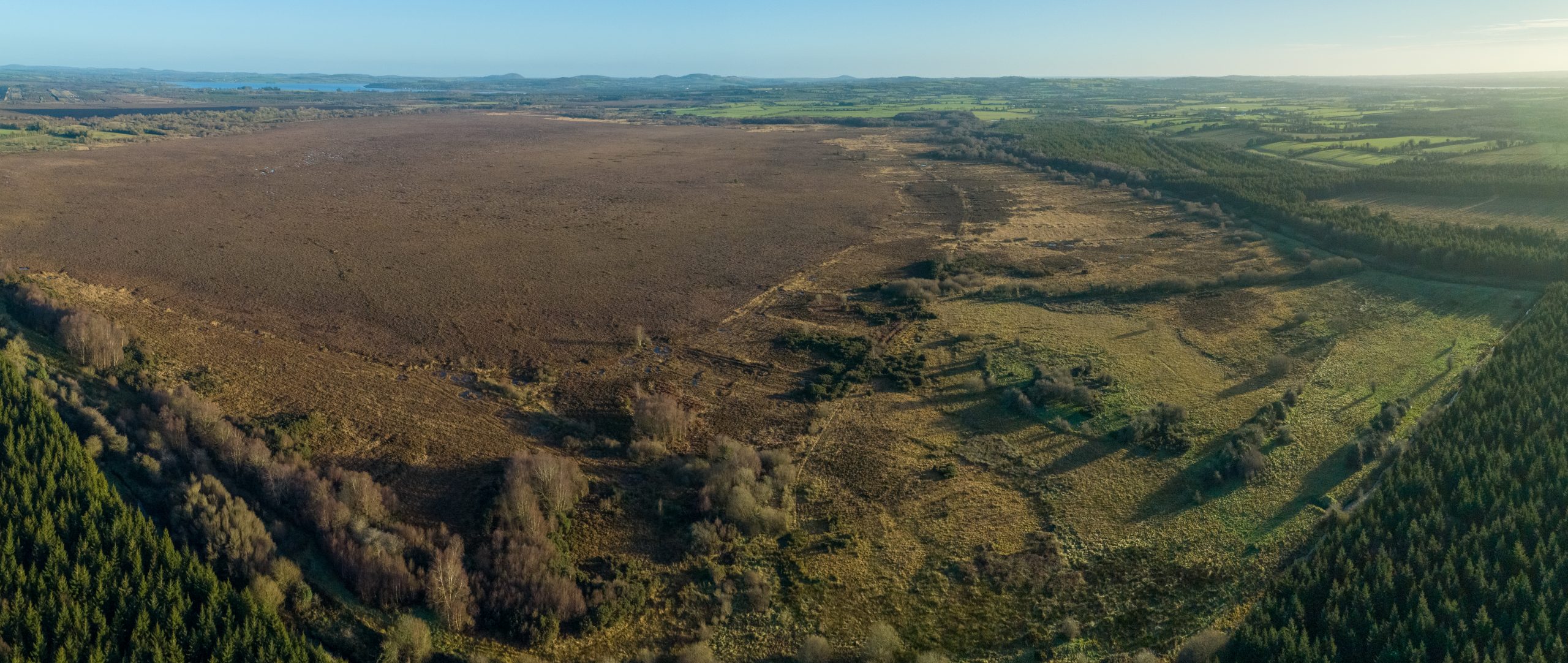
Garriskil Bog SAC near Mullingar, Streete, Rathowen and Ballinalack. Pic: Skyfab/Declan Murray for NPWS
-
-
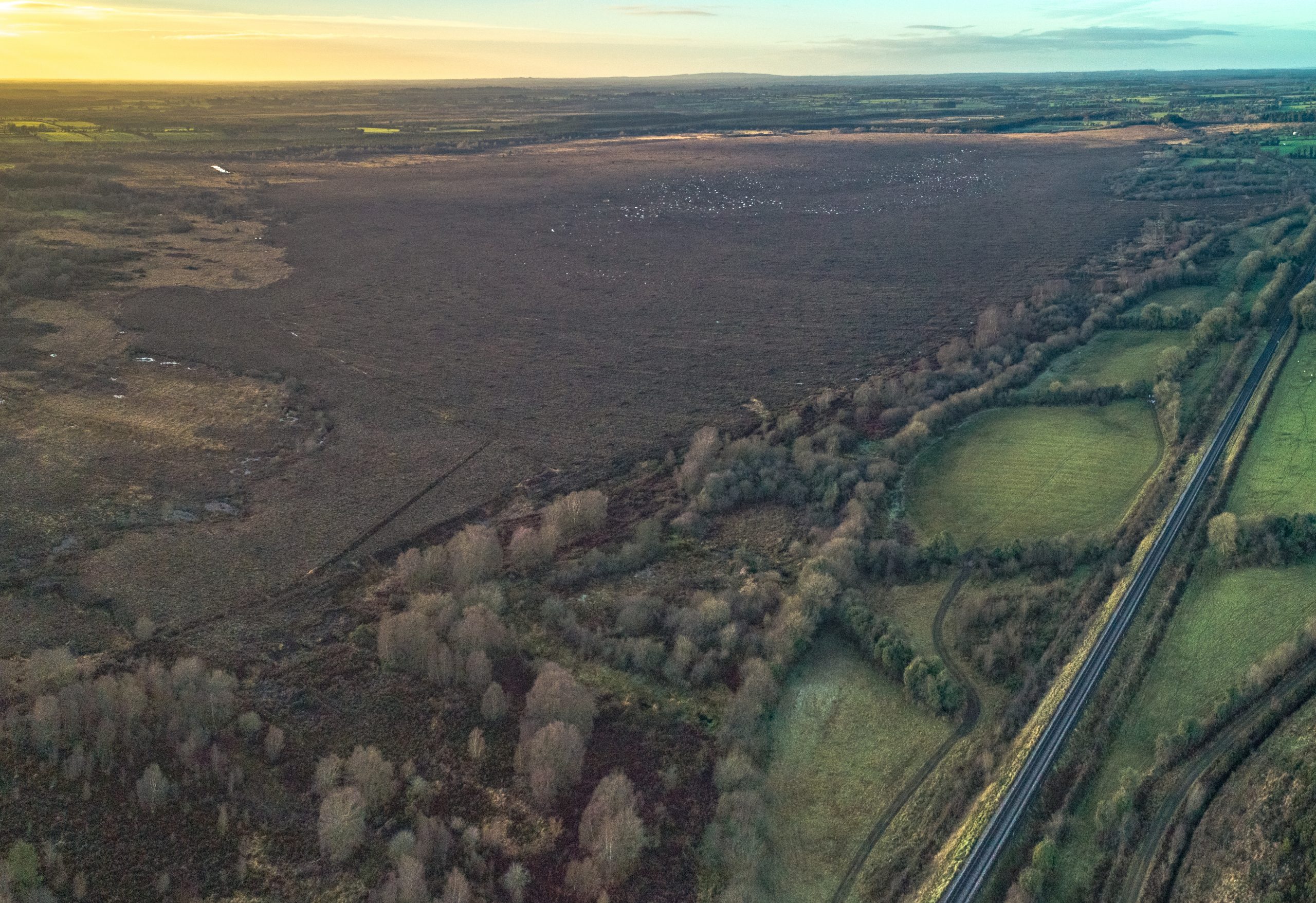
Garriskil Bog Co Westmeath. Pic: Skyfab/Declan Murray for NPWS
-
-
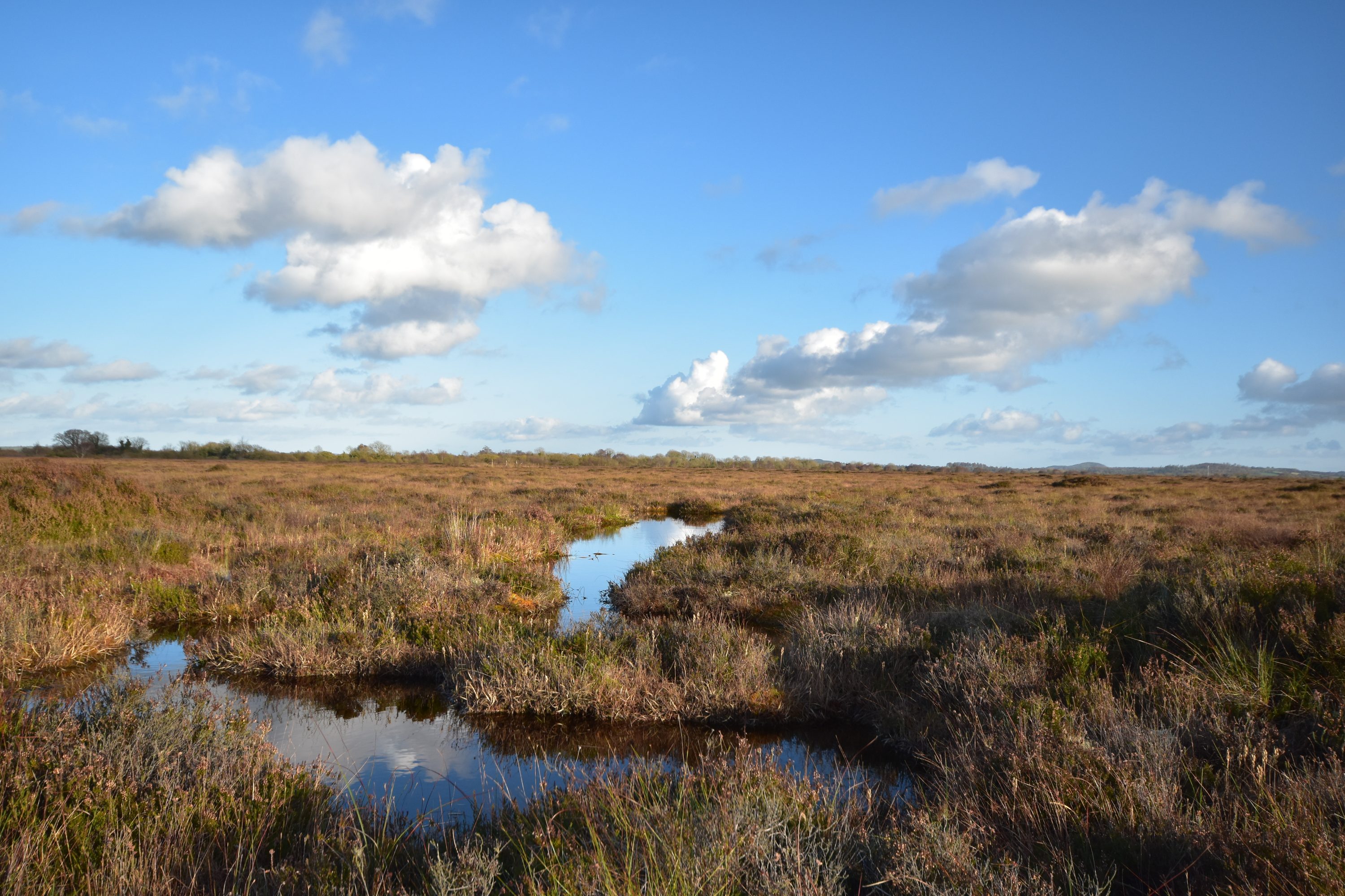
It’s like an alien landscape isn’t it? Garriskill Bog SAC by SkyFab/Declan Murray for NPWS
-
-
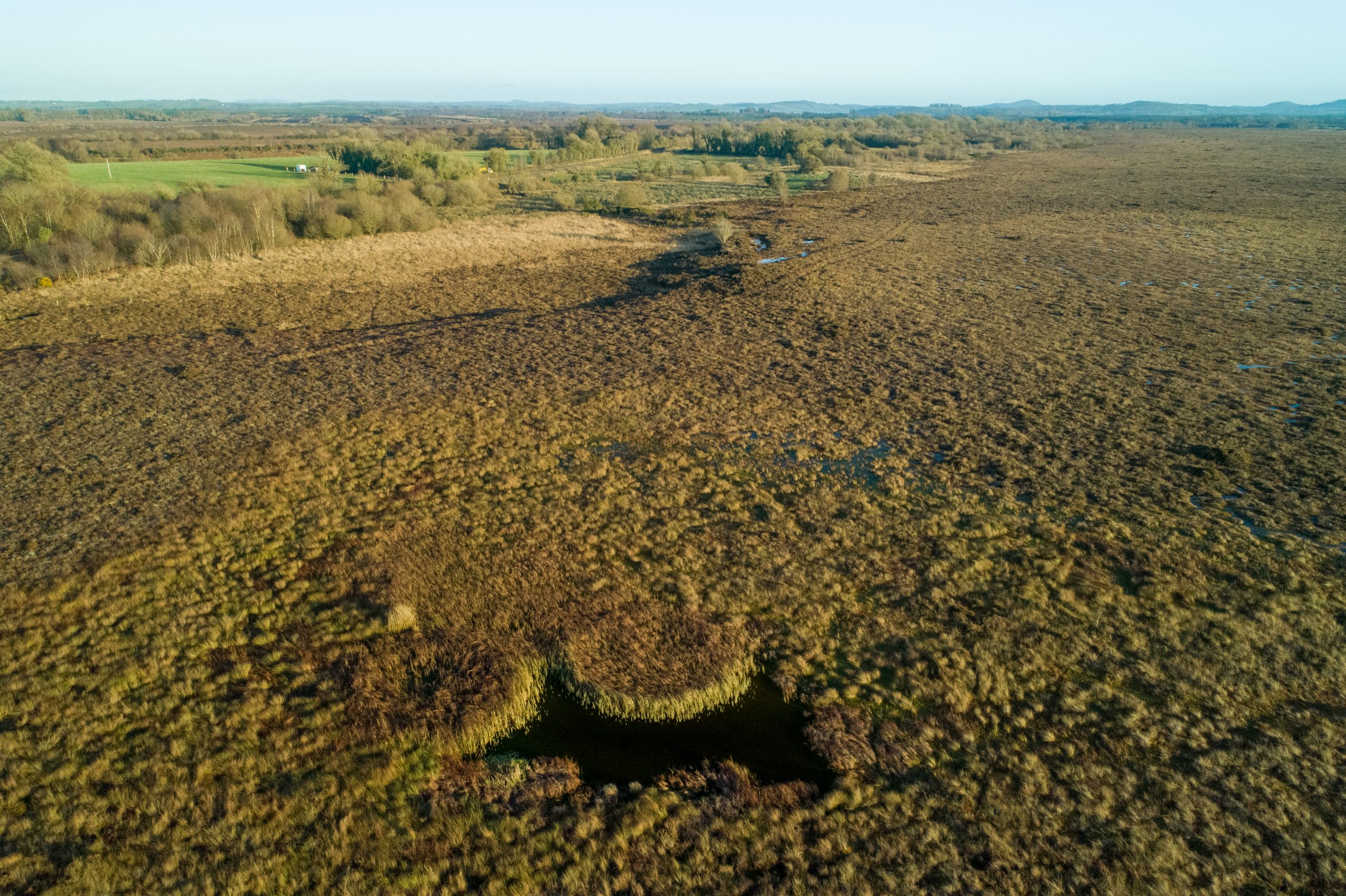
Blocked drains on the high bog at Garriskill Bog in Co Westmeath. Pic: Skyfab/Declan Murray for NPWS
-
-
-
Blocked drains on both cutover and high bog. Pic: Skyfab/Declan Murray for NPWS
-
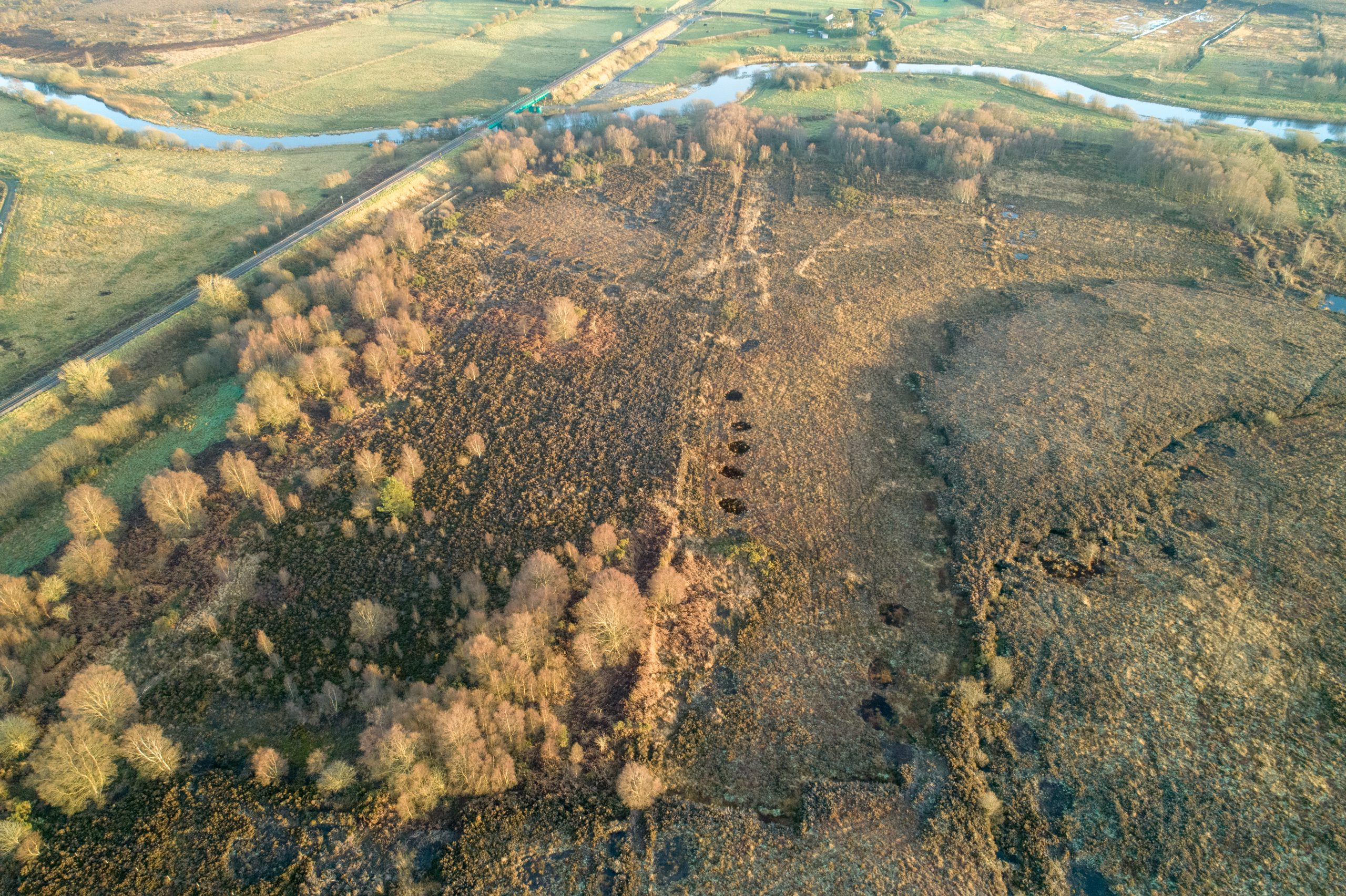
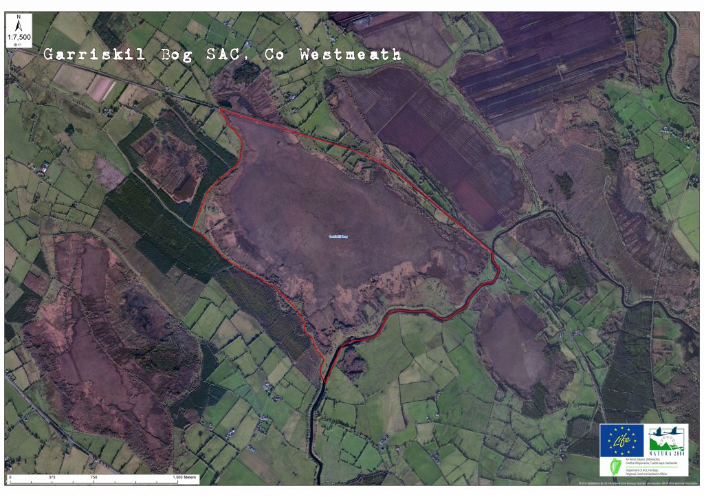
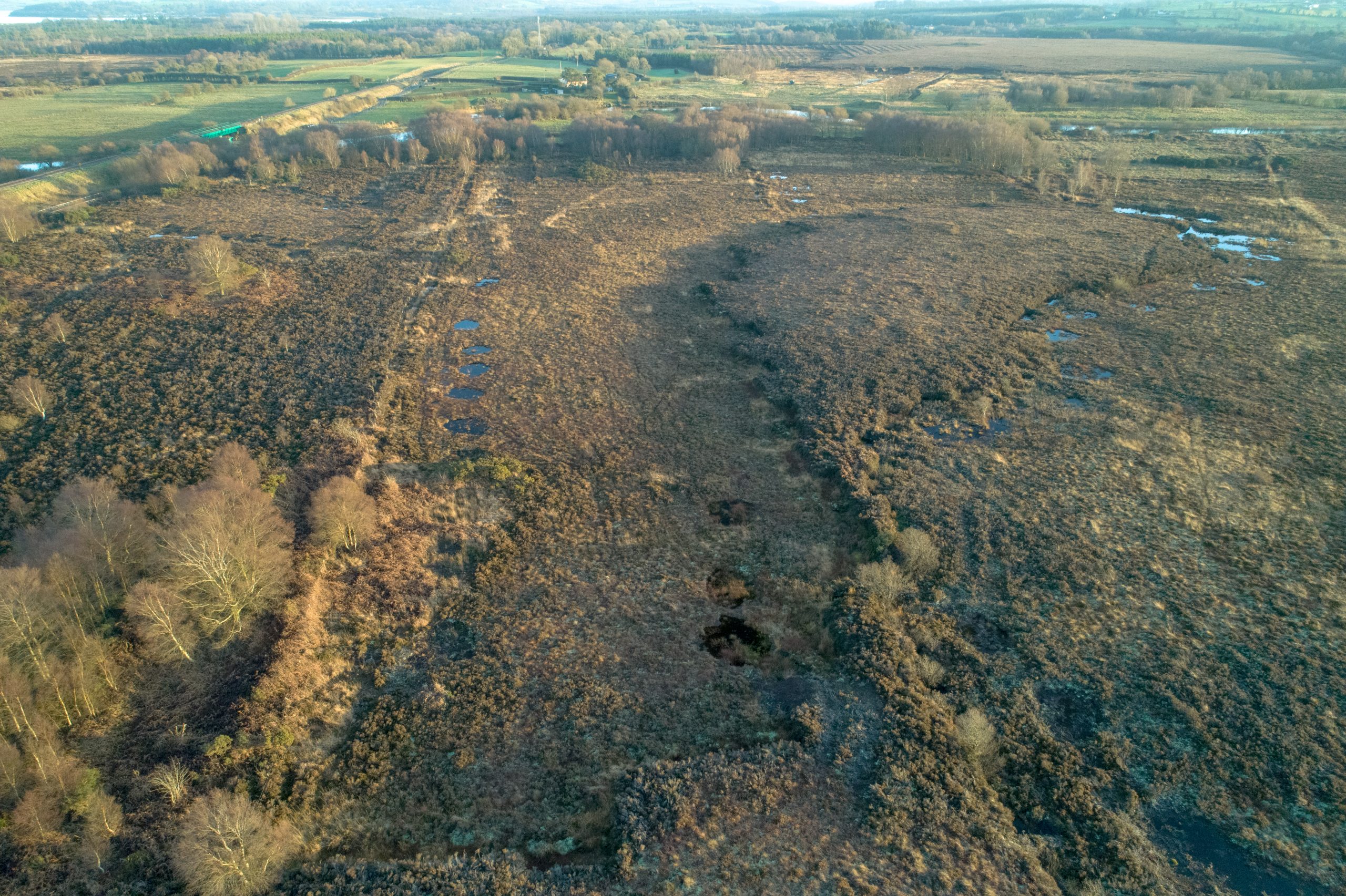
Garriskil Bog is bounded to the south-east and south-west by the rivers Inny and Riffey and by the Dublin-Sligo railway line to the north with the former Inny Junction station close to the site. In days long before the car became the preferred mode of transport and when emigration was rife, the Inny junction (which overlooks the bog) was a place where many midlanders took their last look at an Irish bog. Uniquely it was, at one stage, the only train station in the entire British Isles not be serviced by a road! (See HISTORY section for more)
Garriskil Bog SAC from the air, with the Sligo-Dublin rail line running alongside (bottom right). You can see where the old Cavan-Mullingar line branched off to the right. A horticultural peat production bog is located to the right of the rail line. Pic: NPWS
The site is a Special Area of Conservation (SAC) selected for the following habitats and/or species listed on Annex I / II of the E.U. Habitats Directive (* = priority; numbers in brackets are Natura 2000 codes):
[7110] Raised Bog (Active)*
[7120] Degraded Raised Bog
[7150] Rhynchosporion Vegetation
Peat cutting no longer takes place at Garriskil Bog. Fernandez et al. (2005) mentioned the absence of peat cutting during the 2004/5 survey and also the lack of cutting in 1995 as reported by Kelly et al. (1995). Although cutting has not taken place at the site for a long time, it is estimated that 49% of the bog has been cutaway since the 1840s. Old face banks and cutover drainage along the southern half of the site are likely to continue causing negative impacts on the high bog habitats.
Degraded Raised Bog (DRB) habitat corresponds to those areas of high bog whose hydrology has been adversely affected by peat cutting, drainage and other land use activities, but which are capable of regeneration to ARB within 30 years.
The Rhynchosporion habitat occurs in wet depressions, pool edges and erosion channels where the vegetation includes White Beak-sedge (Rhynchospora alba) and/or Brown Beak-sedge (R. fusca), and at least some of the following associated species, Bog Asphodel (Narthecium ossifragum), sundews (Drosera spp.), Deergrass (Scirpus cespitosus) and Carnation Sedge (Carex panicea).
The bedrock geology of the bog is carboniferous limestone. This site is underlain by calcareous shales with a low permeability. Clays and clayey limestone tills are thought to form the subsoils. This bog has been classified as a Ridge River C bog (morphological type) (Kelly et al., 1995) and as a Midland Raised Bog (Cross 1990). The bog is roughly shaped as a rhomboid that has the longest axis orientated northwest-southeast. There are small protrusions of high bog at each of the corners. The bog lies in a regional groundwater discharge zone, however little groundwater influence is evident around the site.