About Ardagullion Bog
The bogs of Longford are vast and varied, but dotted throughout the county are some of the finest small and medium-sized bogs, and Ardagullion Bog SAC is one of the finest.
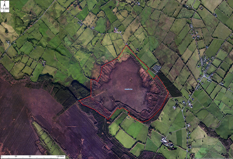
The raised bog that includes both areas of high bog and cutover bog is located 5km north-east of Edgeworthstown, and 8km south of Granard, mainly in the townlands of Cloonshannagh (Coolamber Manor Demesne) and Ardaguillon. It’s total surface area of Ardagullion is just over 117 hectares.
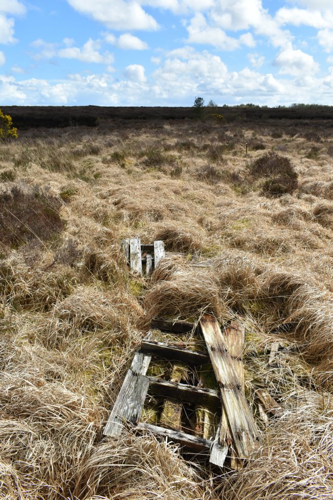
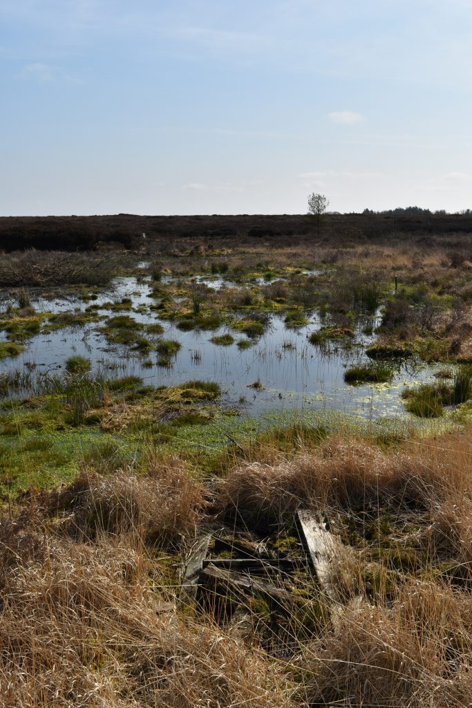
The Living Bog installed almost 800 dams on this bog, during two tranches of work in February 2018 and between December and February 2019. As part of these works, a massive 700m barrier dam was installed alongside the western cutover section of the bog. This brought about instant good fortune for the bog, with wildlife returning and a restored cutover brimming with rare flora and fauna.
Caption: BEFORE Living Bog work on ARDAGULLION 24 04 18. Pic: Ronan Casey
Caption: After Living Bog work on ARDAGULLION 24-03-20. Pic: Ronan Casey
Prior to The Living Bog, most recent surveys (2014) estimated the total area of uncut high bog to be almost 58 hectares while the remaining 60 ha is mostly cutover bog resulting from serious turf-cutting by machine in recent years and by hand in the past.
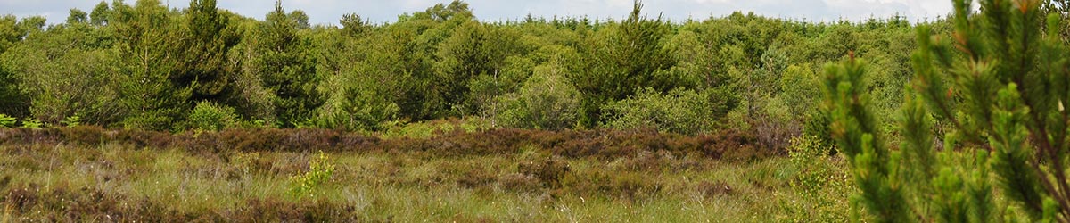
There is a substantial area of uncut high bog here, in a unique shape, though much of this is classified as degraded.
Raised bogs were once quite common in Co. Longford, however most of these were developed for milled peat over the last 50 years and now only a few isolated sites remain (Cross, 1990). The unusually shaped lobe was disconnected from the original area of bog, which was largely strip-mined by machine by a number of different owners.
Peat cutting ceased on the Ardagullion LIFE project site a number of years ago, and a Coillte LIFE project 2004 – 2008 yielded positive restoration results. Areas of cutover in the south and west of the SAC that were previously forested were clear-felled as part of this Coillte LIFE Project.
Click here for more information.
Despite three sides of the triangular raised bog being nipped at right up until its SAC designation a good area of raised bog remains, and restoration prospects are very good.
There are areas of hummocks and pools in the centre of the high bog and the surface is wet and quaking. There is one flush in the centre of the high bog.
The SAC includes the raised bog and surrounding areas of cutover bog, conifer plantation, and wet grassland.
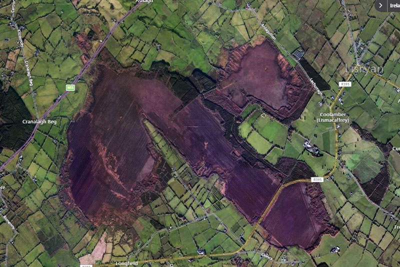
Below is an image of the total bog here, with our project site the remnant north-eastern lobe of a much larger bog that is now largely cutover and, in some areas, afforested. It is estimated that just 8.5% of Ardagullion high bog mapped in the 1800’s remains.
Aside from peat harvesting, the last land uses within the SAC included forestry and agriculture, and some of the bog was reclaimed for agriculture in the past. The forestry is found on a small section of high bog and adjoining cutover in the south-west of the SAC.
Some burning on parts of the high bog was evident in 2012, which resulted in the loss of habitat and damage to the hydrological status of the SAC.
The SAC has been selected for the following Annex I habitats:
• [7110] Active raised bogs (further ranked as priority habitat)
• [7120] Degraded raised bogs still capable of natural regeneration
• [7150] Depressions on peat substrates of the Rhynchosporion